Shift city waste collection and
snow removal into high gear
Shift city waste collection and
snow removal into high gear
Unlock efficiencies with geo-based tracking and management
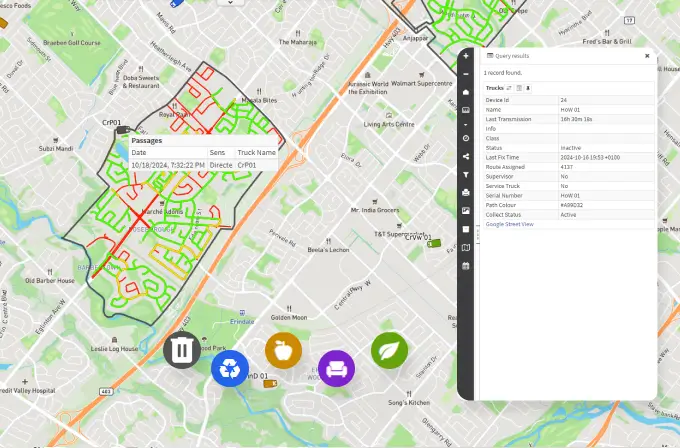
Unlock efficiencies with map-based tracking and management
Waste collection and snow removal aren’t just essential city services, they’re also incredibly challenging. And yet, demands and expectations on public works operations keep growing.
MAPGEARS Streets provides public works management and operations with a powerful tool to leap ahead.
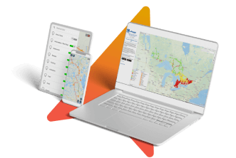
Building on map-based technologies, MAPGEARS Streets gives you actionable information to boost overall performance — increasing operational efficiency and fleet productivity and providing key stakeholders with real-time visibility.
Manage. Track. Optimize.
Visually intuitive interface
boosts operations tracking and management
Color-coded streets
show progress and trouble spots at a glance
Dynamic dashboard
displays active drivers and nearest vehicle
Cloud-based environment
ensures maximum agility and mobility
Real-time and historical
data empowers decision-making and analysis
Tackle waste collection and snow removal with a street-smart solution
Waste collection

Waste collection
- Quickly know what street segments are serviced.
- Know when the collection rate falls in one area.
- Ensure on-time collection by dispatching crews where needed.
- Monitor SLA compliance easily.
- See where the closest vehicle is and reassign it to help out.
- React faster to traffic accidents, natural events or infrastructure failure.
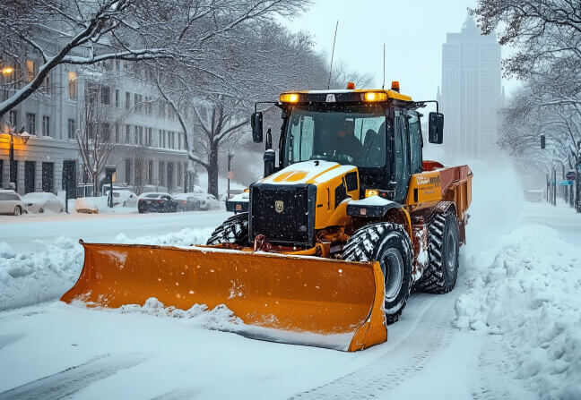
Snow removal
- Track your team's snow removal progress across routes in real-time — simply and cost-effectively.
- Get snow crews and machinery where they need to be.
- Ensure contracted drivers are actively plowing public ways.
- Redeploy plows smartly, knowing what streets need attention.
- Ensure trouble spots are dealt with quickly.
- Help field staff manage street segments.
Snow removal
See Streets in action
Schedule your demo with us.
- Demo - Discover Streets with our experts.
- Live Q&A - Answers to your questions in real time.
- Follow-up support - Always here to help.
Let's set up your demo
Top features and benefits
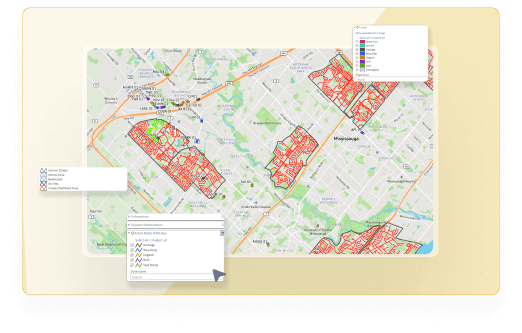
- Assign trucks easily, optimize schedules, and track waste and snow collection in real time.
- Monitor routes, areas, and contracts more effectively.
- Improve safety and coordination with route statuses and accident alerts for drivers.
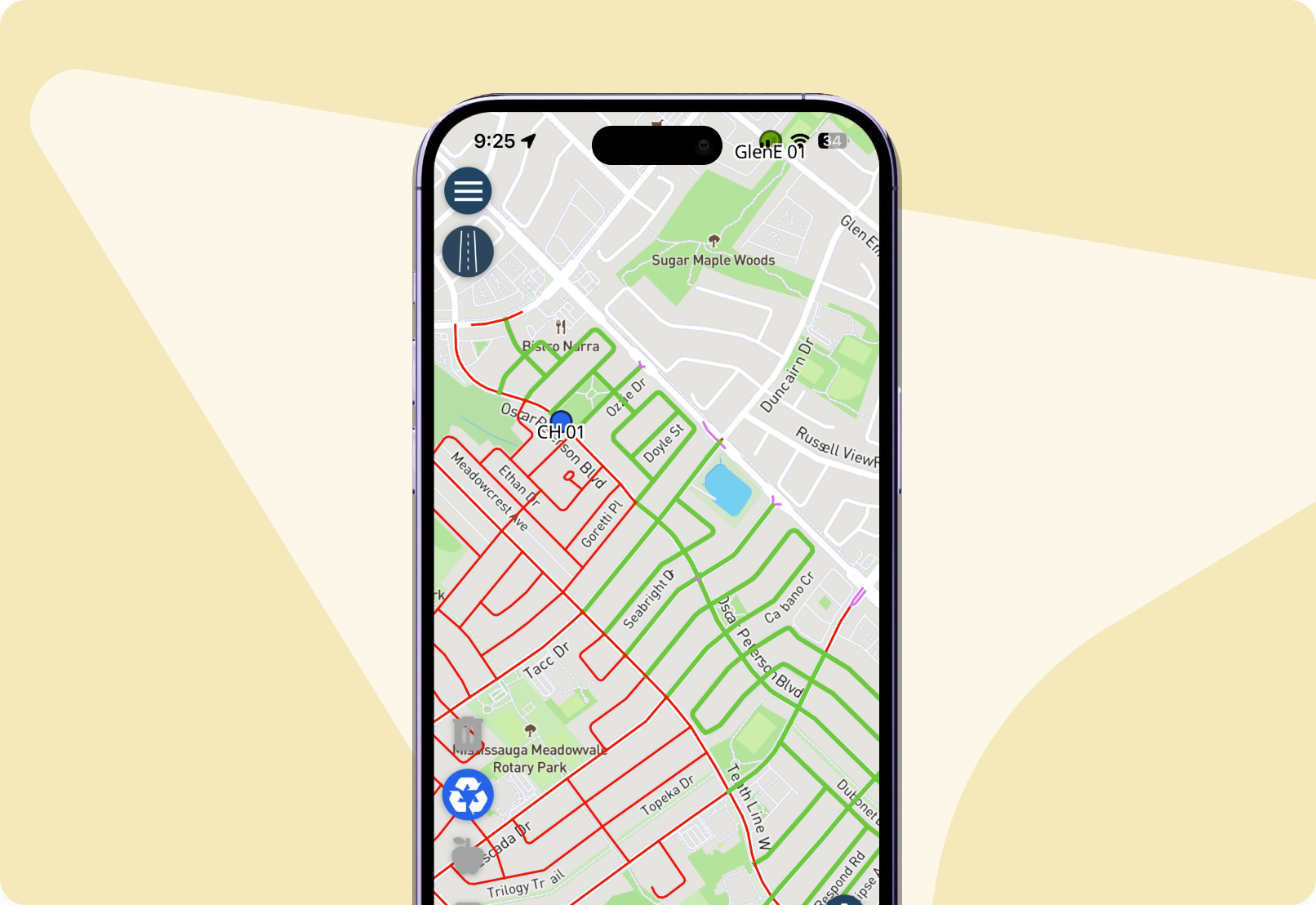
- Provide drivers, contractors, and public works people with the convenience and flexibility to access essential information on the go.
- Streamline communication and dispatching by pushing critical information about accidents, natural events, rerouting and more to specific drivers.
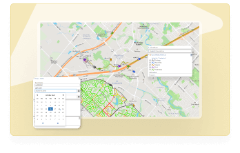
- Empower city officials to respond to citizen calls and crosscheck complaints by leveraging granular information about current and past snow removal or waste collection on street segments.
- Leverage historical data to inform future decisions and demonstrate compliance with SLAs — up to one year of data standard.
- Enhance security and confidentiality without compromising flexibility by controlling viewer access at all levels, from drivers to municipality-specific professionals.
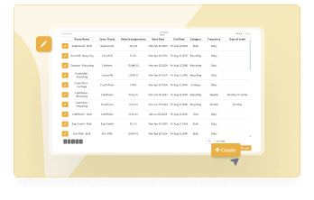
- Increase efficiency and client satisfaction by customizing service contracts to fit specific needs, including sector- and route-specific collection frequency and timing.
- Save time and improve service delivery by automating job creation.
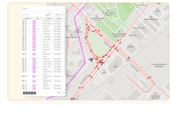
- Drive compliance by creating specific zones and routes for each service contract.
- Modify existing routes or add new ones yourself — from making minor route changes to expanding your service to new areas, you’re in control.
Taking on Old Man Winter in the capital city
Washington’s Department of Public Works Contract Plow Program strengthened its operations by implementing MAPGEARS Streets, completing jobs faster, enhancing transparency, and driving overall success.
Located in the great “Nor’easters” winter storm corridor, the city achieved significant efficiency gains by streamlining processes (like going paperless), improving accountability, and ensuring transparent billing and payments.
Real-time truck deployment and job tracking optimize street operations, while the MAPGEARS Streets Mobile Assistant keeps drivers productive — and satisfied about their work.
How is your city handling snow storms?
Words from the field

Morty Wilkinson
Chief information officer, Waste connections
-20%
Reduced The operational costs
MAPGEARS Streets — FAQ
Quick answer to top-of-mind questions.
Please reach out for more insights!
MAPGEARS Streets optimizes operational resources and results by streamlining processes and providing real-time fleet tracking, route optimization, and historical data for informed decision-making.
Absolutely! MAPGEARS Streets’ Operations Manager allows you to assign routes and drivers instantly, ensuring operational continuity even during last-minute changes.
Indeed it can. Your clients can check real-time and past operational data directly on MAPGEARS Streets’ City Viewer, speeding up response times and reducing the workload on people.
MAPGEARS Streets is compatible with location data from Android and iPhone mobile devices.
We can help you track various job types. Please schedule a session with us and we’ll gladly tell you more.
Totally. MAPGEARS Streets allows you to produce detailed reports on routes, sectors, and periods, each with insights that inform decision-making and drive efficacy.
Are you making progress on city street waste collection?
